Elefsis Port
- Thursday, 12 October 2017 08:02
- Written by Revezas Agency
Position
Latitude: 38.034240
Longitude: 23.541834
Additional Info
- Port latitude 38.034240
- Port longitude 23.541834
Nafplio Port
- Thursday, 12 October 2017 07:41
- Written by Revezas Agency
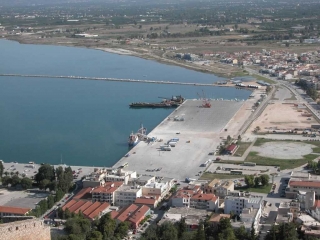
Nafplio Port is in the Peloponnese that has expanded up the hillsides near the north end of the Argolic Gulf.
The port managed by Nafplio Port Fund (Limeniko Tameio Nafpliou). It’s a small port but very safe.
The length of commercial quay is on about 250 mtrs and the max draft 6.20 mtrs.
Position
Latitude: 37.569873
Longitude: 22.800710
Additional Info
- Port latitude 37.569873
- Port longitude 22.800710
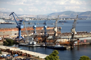
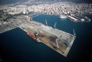
Thessaloniki Port
- Thursday, 12 October 2017 06:47
- Written by Revezas Agency
The port of Thessaloniki is on the NW Shore of the Thermaikos Gulf. Alternatively known as Salonica.
Thessaloniki port managed by Thessaloniki Port Authority S.A.
The Port has 6 piers spreading on a 6200-meter-long quay and a sea depth down to 12 meters, with open and indoors storage areas spreading on a total of 600,000 square meters, suitable for servicing all types of cargo. All quays have double/triple rail-lines and are linked to the national and international railroad network.
Position
Latitude: 40.637865
Longitude: 22.920883
Additional Info
- Port latitude 40.637865
- Port longitude 22.920883
Lavrio Port
- Thursday, 12 October 2017 06:19
- Written by Revezas Agency
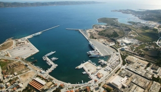
LAVRIO PORT is located around 60 km from the Athens and southeast of Piraeus close to the eastern tip of the Attica Peninsula. Also, the Athens International Airport is around 35 km from Lavrio port, therefore is ideal for crew changes.
The Port of Lavrio managed by Lavrio Port Authority S.A.
The length of commercial quay is 200 mtrs and the max draft 8.50 mtrs.
Position
Latitude: 37.708834
Longitude: 24.058004
Additional Info
- Port latitude 37.708834
- Port longitude 24.058004
Volos Port
- Wednesday, 11 October 2017 08:38
- Written by Revezas Agency
- 1st Quay 475 x 153 x 367 m.
- 2nd Quay 420 x 100 x 460 m.
Position
Additional Info
- Port latitude 39.3601102
- Port longitude 22.9397802
-
Ship's Pre-arrival preparation
 Ship's Pre-arrival Preparation Please find hereunder the required pre arrival documents:…
 -
Stevedores
 The Stylis Stevedores Union is named after the Orthodox Church saint,…
 -
Storage Area
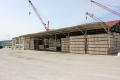 The main storage area inside Stylis port, has shelters and covers…